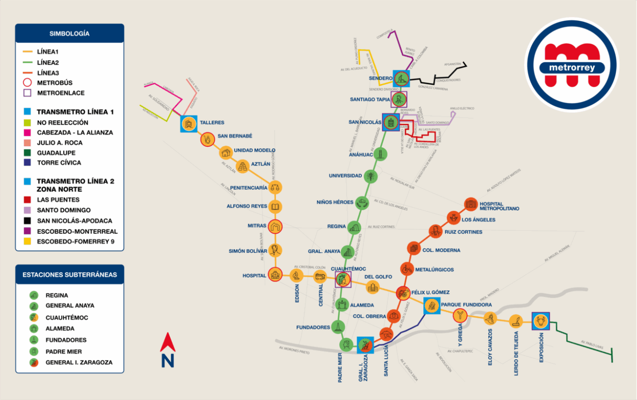
Get ready to navigate the vibrant city of Monterrey with ease. Our comprehensive monterrey public transport map is designed to help residents and visitors alike make the most of the city’s efficient transportation system.
Why Use the Monterrey Public Transport System?
Monterrey boasts a well-developed public transport network that includes buses, metro lines, and taxis. This system provides a cost-effective way to explore the city’s diverse neighborhoods and attractions.
Key Features of Monterrey’s Public Transport
- Extensive bus routes covering the entire city.
- Convenient metro lines connecting major districts.
- Affordable fare options for daily commuters.
Downloading the Map
Don’t miss out on this essential travel companion! The monterrey public transport map is available for free download or printing. This makes it easy to have a physical copy on hand as you explore the city’s cultural landmarks, such as the iconic Macroplaza or the breathtaking Cerro de la Silla.
Visit this article to find the monterrey public transport map and start planning your adventure today!