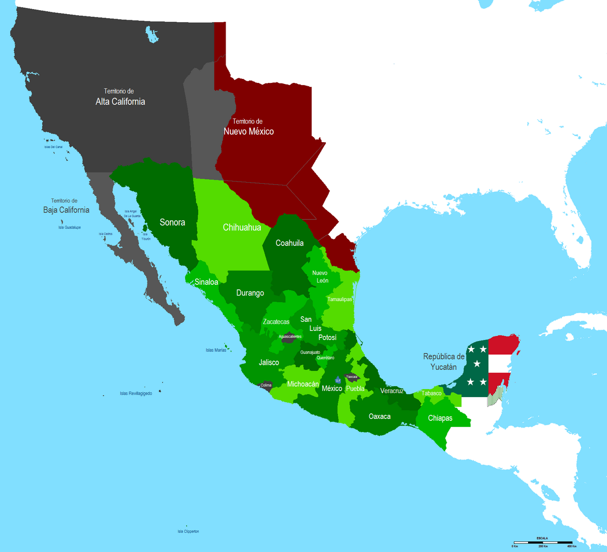
Are you interested in historical maps? The map of Mexican territory in 1845 is an essential resource for anyone looking to understand the geographical boundaries of Mexico during a significant period. This map is available for free download or printing.
Historical Significance
The year 1845 marks a pivotal moment in Mexican history, as it precedes the Mexican-American War. During this time, Mexico faced considerable territorial changes, sparking debates about statehood and national identity.
Features of the 1845 Map
The map of Mexican territory in 1845 showcases key features that were essential to understanding the nation’s geography at the time, including:
- Major cities such as Mexico City and Guadalajara
- Geographic divisions and territories
- Notable rivers and mountains
One of the intriguing aspects of the 1845 map is how it reflects territorial claims that would evolve over the next few decades. By examining this map, historians and enthusiasts can gain deeper insights into the cultural and political dynamics of the era.
You can find the map of Mexican territory in 1845 available for free download or print in this article.