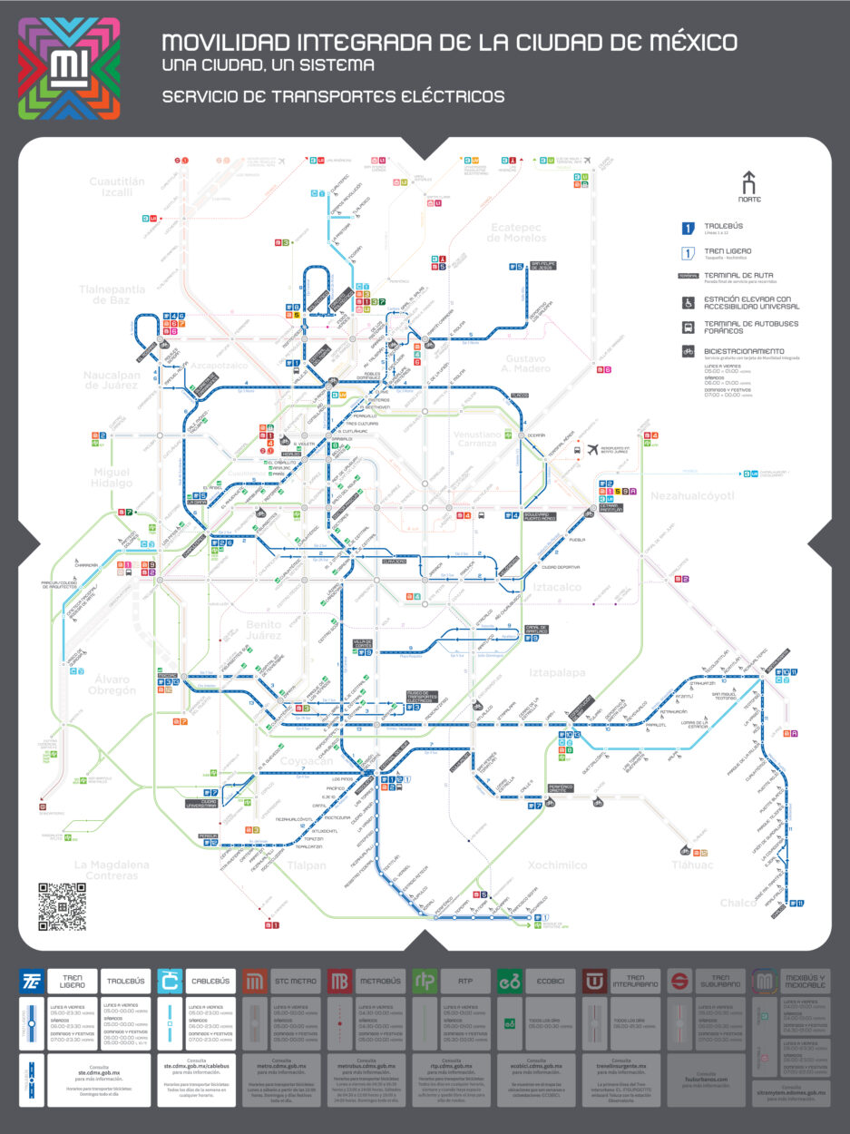
Dive into the vibrant world of public transportation in Mexico City. The mexico city trolleybus map offers a convenient way to navigate the extensive trolleybus network, designed to connect various neighborhoods and attractions seamlessly. This map is available for free, allowing you to print or download it effortlessly.
Why Use the Trolleybus?
Efficient and Eco-Friendly
The trolleybus system is not only efficient but also environmentally friendly. This electric mode of transport reduces air pollution and traffic congestion while providing reliable service across the city.
Key Features of the Trolleybus System
- Extensive coverage of popular areas
- Low fares making it budget-friendly
- Timely schedules ensuring minimal wait times
- Accessibility options for all passengers
Explore Mexico City
Using the mexico city trolleybus map, you can easily visit landmarks like Chapultepec Park, the Historic Center, and the bustling neighborhoods of Roma and Condesa. You’ll appreciate the unique culture, street food, and warm hospitality that Mexico City is famous for.
In this article, you can find the detailed map to enhance your travel experience.